Most commented posts
- Boeing 737-800 Home Cockpit (Linux-based, notably …) — 7 comments
- Boeing 737 Control Columns — 2 comments
- Buttkicker (Füdligingger) under the seat — 2 comments
- Fitting the MIP to the real Cockpit — 1 comment

Apr 20 2018

The Buttkicker Simulation Kit has arrived. After being sold out for years it is finally available again. It’s a fine piece of hardware. Connecting is easy. I’ve screwed the Transducer under the original B737 seat and it makes a difference during flight. What is needed now would be to add low frequency vibrations to individual …
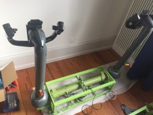
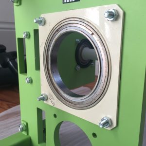
Apr 20 2018
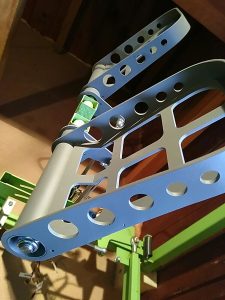
It took some time to rebuild the cockpit so that it would fit the simujabs control column and rudder pedal mechanics. The whole construction had to be raised by around 22 cm which enabled placing the column and rudder mechanics under the “double floor”. The result is fantastic. See yourself … Above images show the …
Dec 21 2017
To enhance a home cockpit with realistic controls instead of just using a simple joystick and gaming rudder pedals is possibly the dream of every cockpit builder. So here it goes … Boeing Airliners still have *real* linked Yoke Columns and Rudder Pedals. And there is quite some mechanical engineering involvend when you want to …
Dec 18 2017
Back in 2004 I started to think about how I could build a real airliner cockpit entirely based on Linux. I At the end of 2017 (and with a grown family) this idea has evolved into a fun project. The way to that goal is still a long and a very creative one. But today …
Apr 26 2016
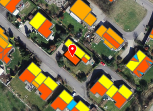
The Swiss Federal Office of Energy SFOE, the Federal Office of Meteorology and Climatology MeteoSwiss, and the Federal Office of Topography swisstopo have created together with Meteotest a stunningly interactive and publicly accessible solar potential estimator for whole Switzerland. www.sonnendach.ch Compared to traditional so-called GIS-type “solar cadasters” this one is really usable. By usable I mean: …
Jan 11 2015
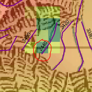
By analysis of our MeteoSwiss high quality satellite-based solar irradiance maps created by the Heliomont algorithm I’ve found that the sunniest place in Switzerland is close to the Monte Rosa hut of the Swiss Alpine Club SAC. During the calculation of the Solar Atlas of Switzerland (to be published as “The Solar Cadaster of Switzerland” on the Geoportal of …
May 24 2012
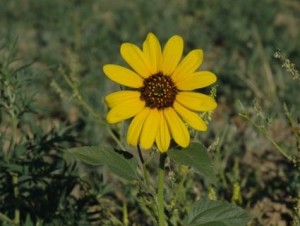
During the last few decades flowering and leafing of temperate and boreal vegetation has advanced by several days in response to warming. The climate sensitivity, as inferred from long-term observations, is estimated to be 2.5-5.0 days per degree C warming. Wolkovich et al. now show in their letter to Nature, that this response cannot be …
May 04 2012
Digital Object Identifiers (DOI’s) are often used to uniquely identify and reference digital content of written documents such as scientific publications or books. This is helpful to track a content over a long time period, where the actual location of the content may change, but any reference to it will have to stay the same. …